Trans-Labrador Highway

Labrador Maps


WHERE IS LABRADOR?


Overview Maps of Labrador


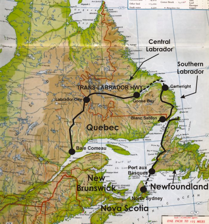
This next map shows how you can do a circle tour of Labrador and Newfoundland:
  1. Take the ferry from North Sydney (Nova Scotia) to Port-aux-Basques in Newfoundland
  2. Drive up the Great Northern Peninsula to the Strait of Belle Isle.
  3. Take the ferry from St. Barbe to Blanc Sablon in Southern Labrador.
  4. Drive east and north to Cartwright.
  5. Take another ferry from Cartwright to Goose Bay.
  6. Drive west across Central Labrador on the Trans-Labrador Hwy to Labrador City and then south on Quebec Hwy 389 to Baie Comeau.

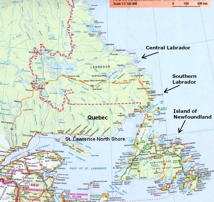
Prior to 2003 it was much more difficult to travel this route, as the ferry to Goose Bay traveled out of Lewisporte in Newfoundland (much farther south). It was the coastal ferry for Labrador, and went north up the coast quite a ways. Delays were common, and it was questionable whether one could get on without a reservation.


This second map is an overview road map of Newfoundland and Labrador


Trans-Labrador Hwy

The material on this page is copyright © by the original author/artist/photographer
This website is created, maintained & copyright © by Walter Muma
Please respect this copyright and ask permission before using or saving any of the content
of this page for any purpose

-- These websites may also interest you --

Ontario Wildflowers   Ontario Trees & Shrubs   Ontario Ferns   Ontario Grasses   Ontario Insects
Mumart   World of Mosses   Wild Ontario   Trans-Labrador Hwy   James Bay Road   Rupert River   Moped Trip
Wildwood Survival   Wildwood Tracking   Leatherwood Trail   Tracker Trail   Earth Caretaker   Wildwood Canada

Thank you for visiting!