|
Central & Western Labrador
|
|
Virtual Tour
Quebec Hwy 389 - Baie Comeau to Labrador City
(Page 1 of 8)
Previous
Next
Most of the written and photographic material for this Virtual
Tour has been generously provided by Mathieu Gagnon. I have mixed in my own
words and photos as well. Thank you Mathieu!! |
|
|
Km 0: Baie Comeau
is where this
road begins. This is the last town until
Fermont and Labrador City (585km from here). Stock up on food and gas,
especially on gas since the price will rise a lot as you travel north (it's a
remote area). In September 2004, the gas was $0.86/L in Baie-Comeau vs $1.04/L
up north. The food was about the same price.
From here to Manic 5 (212km) the road is paved, but it is twisty, narrow, and very hilly, with no real
shoulder. No gas until the
Manic 5 dam, 212km to the north.
There are lots of logging trucks along this section, and they
really move when they are driving north empty. They probably
appreciate it if you find a good place to pull over and allow them to
pass. You'll also have a less stressful drive without them up your
rear end.
If you are going to Manic-5, 215 kilometers away, a rush drive can take you
there in 2 hours, but a normal drive will take 2 hours and a half since there is
a lot of curves, and a smooth drive can take up to 3 hours. If you are going to
Fermont, 565 kilometers away, a rush drive can take you there in 6 hours, a
normal drive in 7 hours and a smooth drive in around 8 hours. If this is your
first time and you are planning to take a lot of pictures and wander here and
there to marvel at the scenery (which I strongly suggest you do), plan more than
8 hours for the trip. Don't forget that Labrador City is in the Maritime
Provinces, thus 1 hour later than in Quebec and Ontario. |
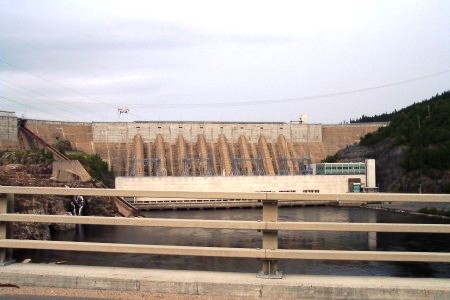 |
Km 22: Manic-2 Dam, visible from
the road. A free guided tour of 1½ hrs is
offered during the summer and reservations are recommended. You will see
how electricity is produced among other things. Great tour, but if you
are short on time, I suggest you save it for the free guided tour of
Manic-5 instead, and/or Churchill Falls
Hydro Quebec website (Manic 2) |
|
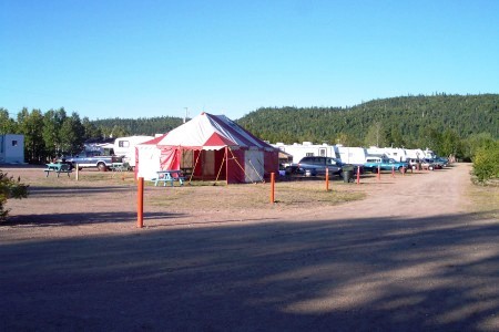 |
Km 24: Manic-2 campground on the
left side of the road. Great place. The camp sites are located past
those of the trailers and are wooded. There is also a small lake on the
north side where you can see Hwy 389 and swim. Water, electricity,
showers and restaurant available. (418) 296-2810. |
|
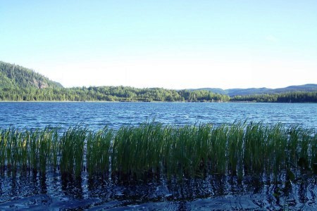 |
Km 24: The lake at Manic-2
campground |
|
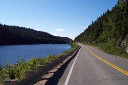 |
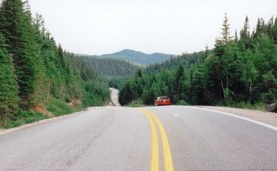
Km 50: Picture (looking south) of
the road running along the shore of a small lake. You will pass some
small lakes on your way up to Manic-5, which make for some great
pictures. |
|
|
Km 52: Emergency phone. |
 |
Km 78: Typical scenery and road
along here |
|
|
Km 126: 50th Parallel. |
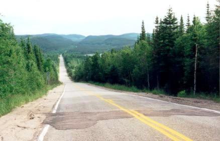 |
Km 130: More typical scenery |
|
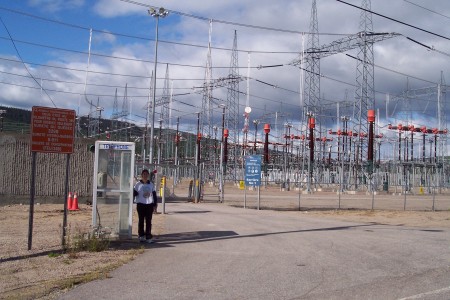 |
Km 165: Emergency phone. Transformer station. This is where the electricity goes up to 735-kV.
On this picture, you can see one the emergency phone along the road and
the transformation station, but the picture doesn't give it justice
because it is HUGE. You only see a part of it on this picture. |
|
|
Km 197: Emergency phone. |
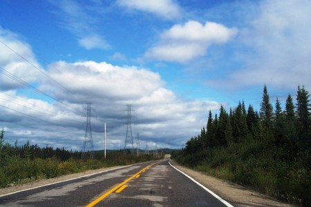 |
Km 200: Picture of the road
following some power lines. You know that Manic-5 can't be far away now! |
|
|
Km 214: Motel de l'Énergie. Just before you come to Manic-5 there is a
motel and small restaurant where you can buy gas. Beware, the gas is not
cheap... |
|
|
|
Previous
Next
Photos and narrative on this page by Mathieu
Gagnon & Walter Muma |
|
|
