|
Central & Western Labrador
|
|
Virtual Tour
Quebec Hwy 389 - Baie Comeau to Labrador City
(Page 2 of 8)
Previous
Next |
|
|
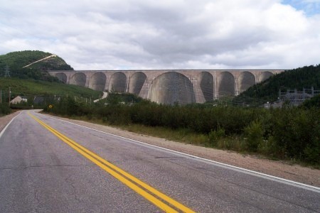 |
Km 214: You make a turn thinking
there will be nothing more than trees and you see something unreal
instead: the dam of Manic-5! It is so HUGE and it will keep on growing
as you drive towards it! You will never forget this moment! There is gas available here; the last for 104km.
Also, the pavement ends here. You will be on gravel road
for the next 916km to Goose Bay, except for the 90km stretch from
Gagnon to Fire Lake, the 20km between Fermont and Labrador City, and the
1km through Churchill Falls.
|
|
 |
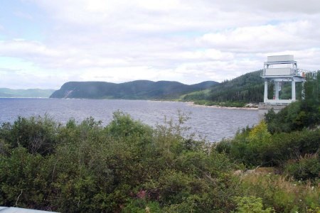
Km 216: Manic-5 dam. Restrooms,
souvenirs, but no picnic tables! Stop at the building on your left and
register for the free guided tour of the dam (during the summer). It is
well worth it! You will visit the installation, go inside the central
arch and on top of the dam. Reservations are recommended.
Hydro Quebec website: Manic 5This photo shows the road northward
- it is the small gravel road climbing beside the far side of the dam
across the valley in the center of this photo. |
|
 |
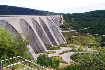
Another view of the dam. It is the
largest dam of its type in the world. |
|
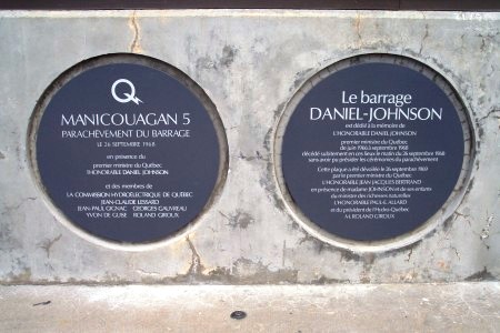 |
On your visit of the dam, you will stop on
top of it at the official plate. It says that Manic-5 was completed in
September 1968 and was renamed Daniel-Johnson the year after in honour
of this Premier of Quebec because he died on site the night before the
inauguration of the dam in 1968. This is why the dam has two official
names. |
|
 |
View of the Manicouagan Reservoir from the
top of the dam. |
|
 |
When you look south from the top of the
dam, you can see the road leading south to Baie-Comeau. The gray
building (on your right on the picture) is where you may stop to
register for a tour. You can't go on top of the dam with your car -- you
have to take the free guided tour.
If you continue north to Fermont and Labrador City, you will cross
the bridge and go towards the left ion the photo. |
|
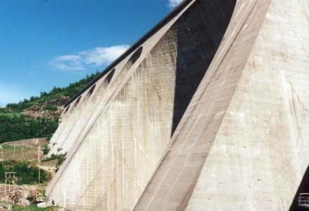 |
This dam is huge - for scale
note the relative size of the power line poles in the lower left corner of the
picture. |
|
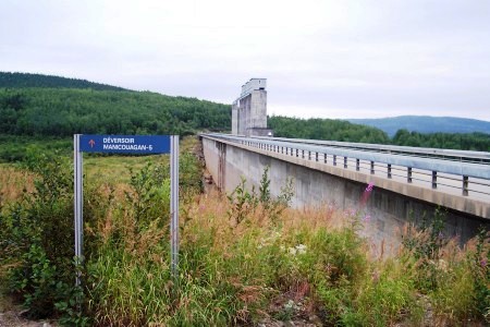 |
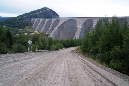
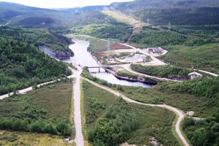
Continuing north, after you climb a very
steep hill, you come across the overflow weir of the Manic-5 dam. The
road (finished in 1986) crosses it to continue the trip north to Fermont
and Labrador City. |
|
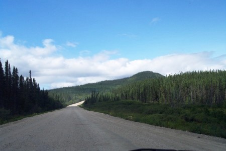 |
Km 220: This is what the road looks
like after Manic-5. No more paved roads for a while! Be careful in the
curves: your car may slide if you hit loose gravel or hit an oncoming
vehicle (even if you haven't seen one in the last hour) which may be
coming from the other way. There are a lot of curves in the first few
kilometers. As mentioned above, and it bears repeating: You will be on gravel road
for the next 916km to Goose Bay, except for the 90km stretch from
Gagnon to Fire Lake, the 20km between Fermont and Labrador City, and the
1km through Churchill Falls. |
|
|
|
|
Previous
Next
Photos and narrative on this page by Mathieu
Gagnon & Walter Muma |
|
|
