|
Central & Western Labrador
|
|
Virtual Tour
Quebec Hwy 389 - Baie Comeau to Labrador City
(Page 3 of 8)
Previous
Next |
|
|
|
Km 214 through Km 390: For the next 176km, from
Manic 5 north, the road
is gravel. As you can see from the photos it is a modern gravel
road, with easy curves and hills for the most part. However, you
do have to watch out for the sections of deep and loose gravel. If
you don't drive carefully you can easily spin out of control and into
the ditch. |
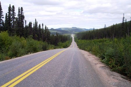 |
Km 260: What's that?! Paved road in
the middle of nowhere?! I don't know why a stretch of about 7 kilometers
was paved here, but since it is here, why not use it! But don't drive
too fast because it ends fast and gravel road may surprise you if you
hit it faster than 100 km/h. |
|
|
Km 267: 51st Parallel. |
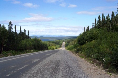 |
Km 285: From
about km280 on, the huge Manicougan Reservoir is visible from time to
time in the distance to your left. This is a large man-made lake created by the
Manic-5 dam. It is visible in this photo. This may be a gravel
road, but you can make pretty good speed now on the long straight
stretches. You can easily drive at 100 km/h most of the time if you feel
confident enough, but don't be overconfident since it may take a few
hours if not days before someone sees your wrecked car in the ditch. By
the way, the speed limit is 70 km/h all the way up to Labrador City. |
|
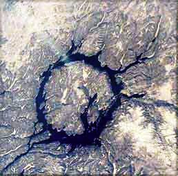 |
Here is a view of the Manicougan
Reservoir from space.
This ring-shaped lake was formed by the
impact of a gigantic meteorite. The lake is 64km in
diameter. The Daniel Johnson dam simply expanded the area of the
existing lake.
The highway travels along the eastern
side of this lake.
|
|
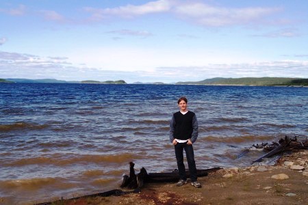 |
Km 288: Be on the lookout for a
private entry on your left. I suggest you drive down here and have a
look at the Manicouagan Reservoir -- you won't have another chance to do
it. Since it's a man-made reservoir, the erosion of the shore is still
ongoing. You can clearly see the earth-brown colored water near the
shore. There are also a lot of dead trees laying on the shore. And since
the water level is not constant, you will see varying layers of erosion.
If you choose to lunch here and marvel at the scenery, and please don't
forget to be respectful of the area, as this is actually private
property. And get yourself a very strong blackfly repellent! Or else the
blackflies will drive you insane in no time! They come fast and in large
numbers.
This is Mathieu Gagnon, the contributor of many of these photographs
and much of the narrative in this virtual tour. Merci Mathieu! |
|
|
|
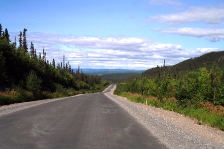 |
Km 300: The road may seem paved on
this picture, but it isn't. |
|
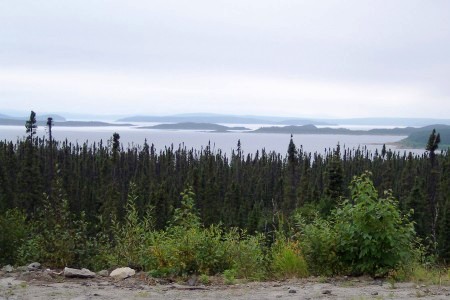 |
Km 315: A breathtaking view of the
Manicouagan Reservoir and Rene-Levasseur Island. Make a stop, you won't
regret it! In my opinion, it's the best view you will have of this
man-made reservoir. |
|
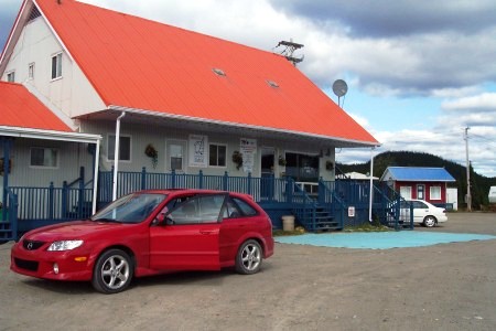 |
Km 317: Relais Gabriel. Gas,
restaurant, motel. (418) 589-8348. It's your last chance to buy gas
before Fermont, 250 kilometers north.
|
|
|
Km 320: Emergency phone. |
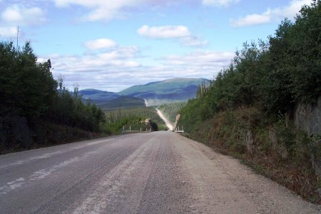 |
Km 330: Another picture of the
magnificent scenery that you drive through. Note the dust from the far
away vehicle.
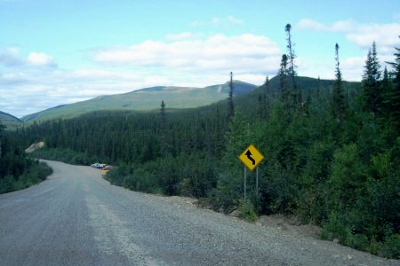
From about Km300 through Km375 the road
passes through a region of moderate sized mountains.
As you can see from these
pictures, there is very little traffic on this road. You don't have
to wait around to get these photos of empty roads. You DO have
to wait around for awhile to get a photo with a car in it!
It's a very lonely highway through huge empty country. Beautiful! |
|
 |
Km 335: Nomade camp at the base of
the Groulx Mountains. Trails going up the various mountains start here.
Official website (in french only):
http://www.monts-groulx.ca |
|
|
Km 336: Prospecteur outfitter, located at the base of the Mounts Groulx,
right after Nomade camp.
|
|
|
|
Previous
Next
Photos and narrative on this page by Mathieu
Gagnon & Walter Muma |
|
|