| km15 |
Labrador City, and a branch
road to Wabush. Both of these towns exist because of mining.
In fact, it's the site of Canada's largest iron ore mine. All of the usual services are available
here. |
| |
|
| km23 |
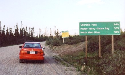 |
As
you leave Labrador City you are presented with these signs.
The yellow one is a "Driver's
Alert": There's no gas, no services, no nothing,
until you reach Churchill Falls, 240km away.
Gravel road for the next 535 km.
|
|
| |
|
| km82 |
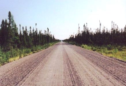 |
Just
mile after mile after mile of spruce trees, rocks, low hills, and bogs.
And dust.
And the SILENCE.
Here's where the SILENCE of this land
really starts to hit home. The only sounds are the occasional bird
song and the breeze (if there is any).
|
|
| |
|
| km100 |
 |
It
was very hot as I drove across Labrador, with very little breeze.
I heard later that it had reached 30 degrees C. under a perfectly clear
sky.
The blackflies in Labrador are
something else!! I thought I was used to them from spending so much
time in northern Ontario. Hah! The Labrador blackflies seem
to be more venomous than those I have encountered elsewhere. They
are also quicker. It was impossible to be outside for more than
10-15 minutes unless there was a breeze. I took to cooking my main
meal of the day at lunchtime, after first searching out a location that
had at least a little breeze. Then I would eat leftovers or a
sandwich for supper while sitting in the car. |
|
| |
|
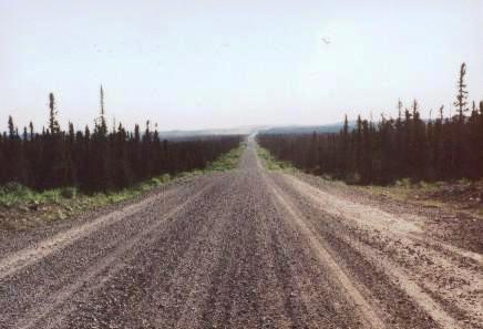
| km180 |
 |
The
road continued to be very empty.
Whenever another vehicle passed going
the other way, a dense cloud of dust hung in the air for some time
afterwards, creating white-out conditions.
Notice the dust cloud raised by
this approaching vehicle. |
|
| |
|
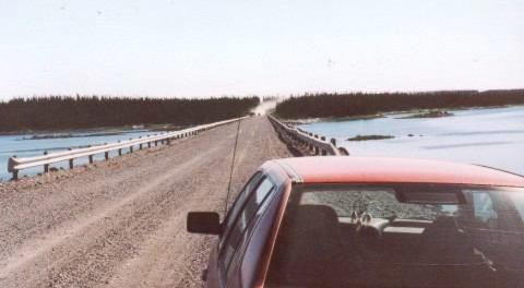
| km243 |
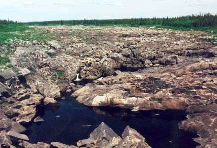 |
Here
the highway crosses the Churchill River (what's left of it).
Although the river is reduced to a
trickle by the diversion of water to the Churchill Falls generating
station, the canyon and the falls are still an awesome sight.
Imagine what this river used to be
like, with it filled bank-to-bank with water surging over these rocks! |
|
| |
|
| |
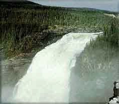 |
Just downstream from here is the site
of the (former) Grand Falls.
And here is what the falls used to look
like. |
|
|
|
|
| |
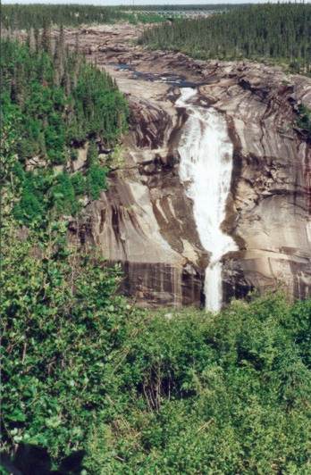 |
And here's what they look
like today. The trail
to the falls is on the south side of the highway, at the west end of the
bridge. Don't be put off by the "trail closed" sign - it
was put up because a plank bridge across a small stream is falling apart.
|
|
| |
|
| |
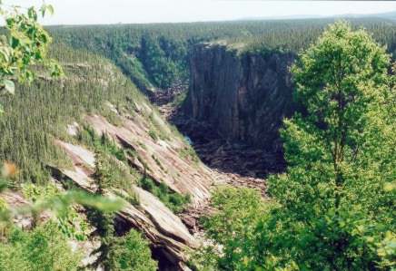 |
This
is the canyon below the falls... |
|
| |
|
| km265 |
Churchill Falls
town.
A small town of about 600, it is entirely owned and run by the Churchill Falls
Labrador Corporation (the power company). This is your last chance
for gas or other supplies until you reach Goose Bay, 288km to the east.
Churchill Falls receives an average of
5 meters of snow each year! For this reason the houses are all
built on only one side of each street - makes it easier to plow the
snow.
The tour of the Churchill
Falls generating station is worthwhile. The actual generating
station is almost 1000 feet underground. You must book a spot for
the tours (free) in advance, at the town office (which is pretty hard to
find - ask someone). I was lucky - I walked in 10 minutes before a
tour was to start and got to go on it. |
| |
|
| |
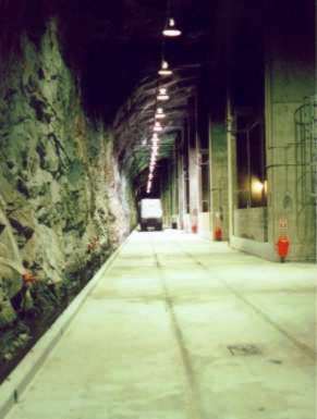 |
This is a picture of the
main transformer gallery. |
|
| |
|
| |
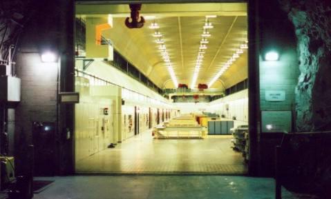 |
And this is the generator room, where
the power is actually produced.
All of this was drilled out of solid rock almost 1000 feet underground.
Most of the power is sent southward to
Quebec. |
|
