| km306 |
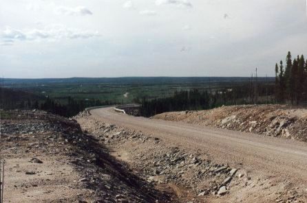 |
Here's the typical scenery
along the way from Churchill Falls to Goose Bay. Long, wide views,
low hills, forest as far as the eye can see. There have been
numerous forest fires along this road. |
|
 |
|
| km460 |
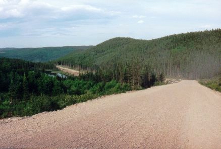 |
Here the highway begins a long
descent down from the central Labrador Plateau. When you reach the
bottom after many miles, the vegetation has changed remarkably.
Once again there are tall trees, and there are species other than black
spruce. I don't know how far the road descends, but the
elevation change must be substantial. |
|
| |
|
| km513 |
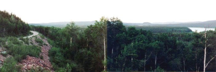
Here is a broad panoramic
view looking east towards Goose Bay (which is still 47 km away).
To the far right the Churchill River is visible. |
|
|
|
|
|
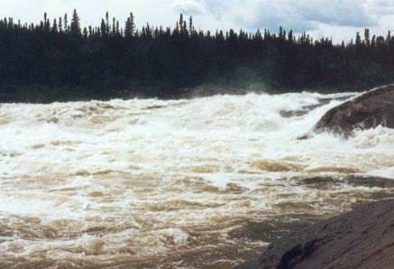
| km 525 |
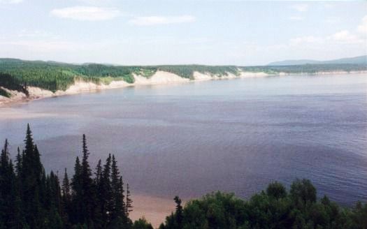 |
West of Goose Bay the
Churchill River widens out considerably. This picture was taken
from the lookout just downstream from Muskrat Falls. |
|
| |
|
| km 525 |
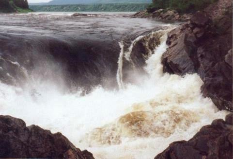 |
And here is Muskrat
Falls. The Churchill River surges over these rocks in a wild
cascade of thundering water. Absolutely awesome!! |
|
| |
|
| |
 |
Enjoy these falls while you can - they
will be eradicated in a few
years. There is serious work underway to "develop" these
falls as a hydro-electric project. These magnificent falls and rapids
will be silenced to satisfy our greedy
appetite for wasting electricity.
Please take a moment to pause and think
about all the myriad ways in which we throw
away precious natural places like this so
that we can over-light our cities and
dwellings, and power needless "labour-saving"
electrical devices. |
|
| |
|
| km540 |
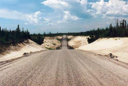 |
Towards
Goose Bay there is a
lot of sand.
The road here drops suddenly down and
then steeply up across several river valleys. No guardrails here,
so be careful - it's sometimes a long way down.
|
|
| |
|
| |
Goose
Bay is a major air force base where NATO countries play and train.
There are several signs along the TLH warning about low level jets
flying at supersonic speeds.
At
Goose Bay I stayed in a bed and breakfast place (mainly to get away from
the blackflies), took a side trip to Northwest River to get to the true
end of the road, and then turned around and came back - all the way back
to Baie Comeau. Then on to part 2 of my trip.
[PRIOR TO 2003:]
From Goose Bay you can elect to take
the ferry down to Lewisporte on the island of Newfoundland, if you don't
want to drive back the same way, and if you can get on (best to reserve ahead).
NEW IN 2003:
The ferry now travels to Cartwright, in Labrador. From
there you drive south to Blanc Sablon, which is on the
north shore of the Strait of Belle Isle. You would then
take a ferry across the Strait to St. Barbe on the Great
Northern Peninsula of Newfoundland. |
| |
|
| km182 |
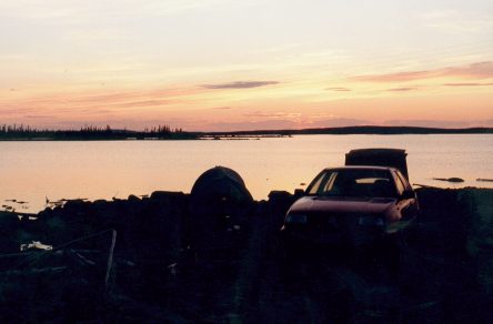 |
One last picture on the
Trans-Labrador Highway....
Here's
a nice campsite and sunset on Ossokmanuan Lake on the way back.
I say "nice" meaning that
there were no flies hovering around! I was in the middle of a
large area of gravel.
This is the only time that I camped
outside on the entire trip where I was able to wash outdoors (because of
the flies). There was a nice breeze here, and I was a fair
distance from the forest.
|
|
